Notes from Northumberland
The story of a self-taught illustrator and designer living in England’s most northerly county
Six things an illustrated map can do that no other format can
Over the past few years I've worked on illustrated maps for a wide range of clients: heritage organisations, farmers, authors, and private individuals commissioning personal gifts. What strikes me, looking back across these projects, is how differently each map was being asked to work. Not one of them was simply about geography.
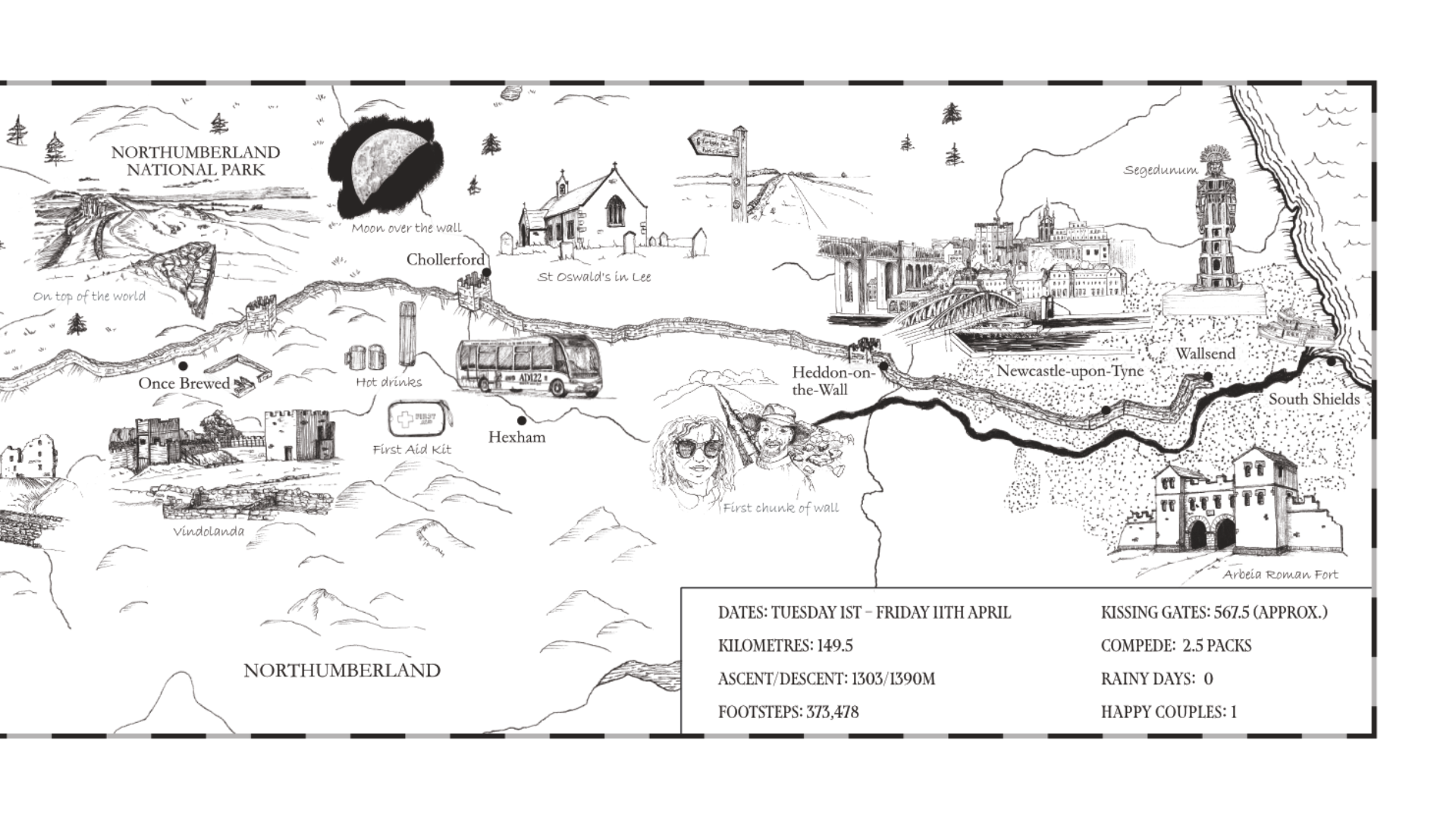
Illustrating a Journey Along Hadrian’s Wall
I love working on these types of commissions as it really showcases the flexibility of map-making. Maps based on experience, emotion and memory aren’t about cartographical accuracy - they’re storytelling in its purest form. Whilst the viewer needs to be able to orient themselves - perhaps understanding the direction of travel or key landscape features - they aren’t using the map for way-finding. It is about their lived experience of the adventure and the landscape - what they personally noticed, encountered and even endured in the process of their journey - and how they share that story with others.

Bespoke Illustrated Map Gift Featuring Iconic UK Race Circuits
Take a behind-the-scenes look at this bespoke illustrated map commission featuring five iconic UK race tracks. A meaningful gift created in ink and watercolour for a 70th birthday – complete with a custom car illustration and hand-drawn circuit logos.