Illustrating a Journey Along Hadrian’s Wall
Every landscape is rich in stories, but Hadrian's Wall country in the North East of England could be said to be in a league of its own. For 300 years the Wall marked the furthest north-western frontier of the Roman empire, a man-made barrier set atop a series of geographical features rooted in even older geology - the Whin Sill - a hard black dolerite rock forming crags and easily defended sites for forts and castles, with views for miles.

A section of Hadrian’s Wall with the remains of a Milecastle (Petra Nesti via Pexels)
Stand in this landscape and you can feel rooted to the past - imagining the stories of all those who have travelled here before us and our own adventures here become stories we tell and re-tell; something we want to keep.
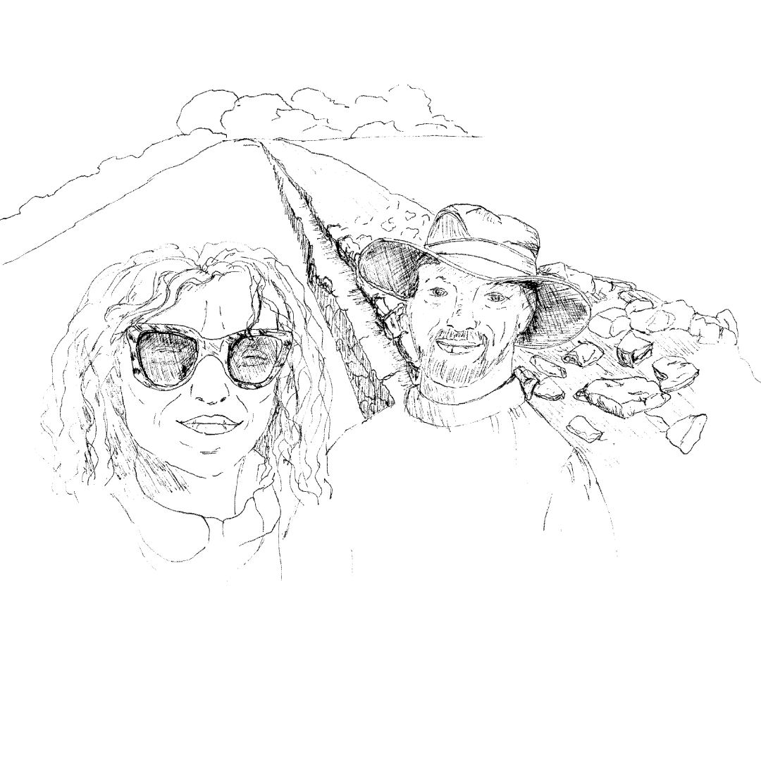
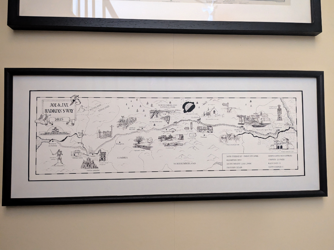
This was exactly what my client, Jackie, was looking for when she came to me last summer to ask if I could create an illustrated map to celebrate the journey she and her husband had made in walking the Hadrian’s Wall Path together. This is an 84-mile signposted footpath stretching from Wallsend in Newcastle-upon-Tyne in the east to Bowness-on-Solway in the west, following the line of Hadrian's Wall. A journey along this trail takes in everything from rolling fields to rugged moorland, Roman remains, castles, battlefields and all manner of wildlife.
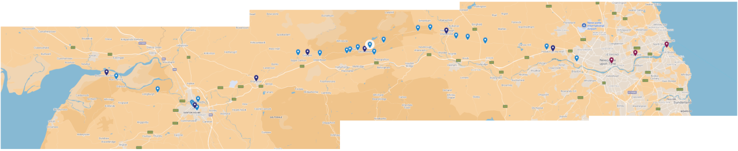
The Hadrian’s Wall Path stretches from coast-to-coast
I love working on these types of commissions as it really showcases the flexibility of map-making. Maps based on experience, emotion and memory aren’t about cartographical accuracy - they’re storytelling in its purest form. Whilst the viewer needs to be able to orient themselves - perhaps understanding the direction of travel or key landscape features - they aren’t using the map for way-finding. It is about their lived experience of the adventure and the landscape - what they personally noticed, encountered and even endured in the process of their journey - and how they share that story with others.
Jackie happens to be a writer and so she provided me with an incredibly detailed written description of their day-by-day walking of the Hadrian’s Wall Path, supplemented by a lot of photographs. From this starting point, I suggested creating the map as a long and thin piece (600mmx200mm) along with key points that I thought would illustrate well. We also agreed that the map would probably be most effective rendered just in pen-and-ink and I explained my process and fee for the work.
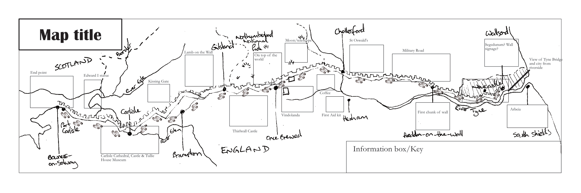
My rough ideas and layout sketch
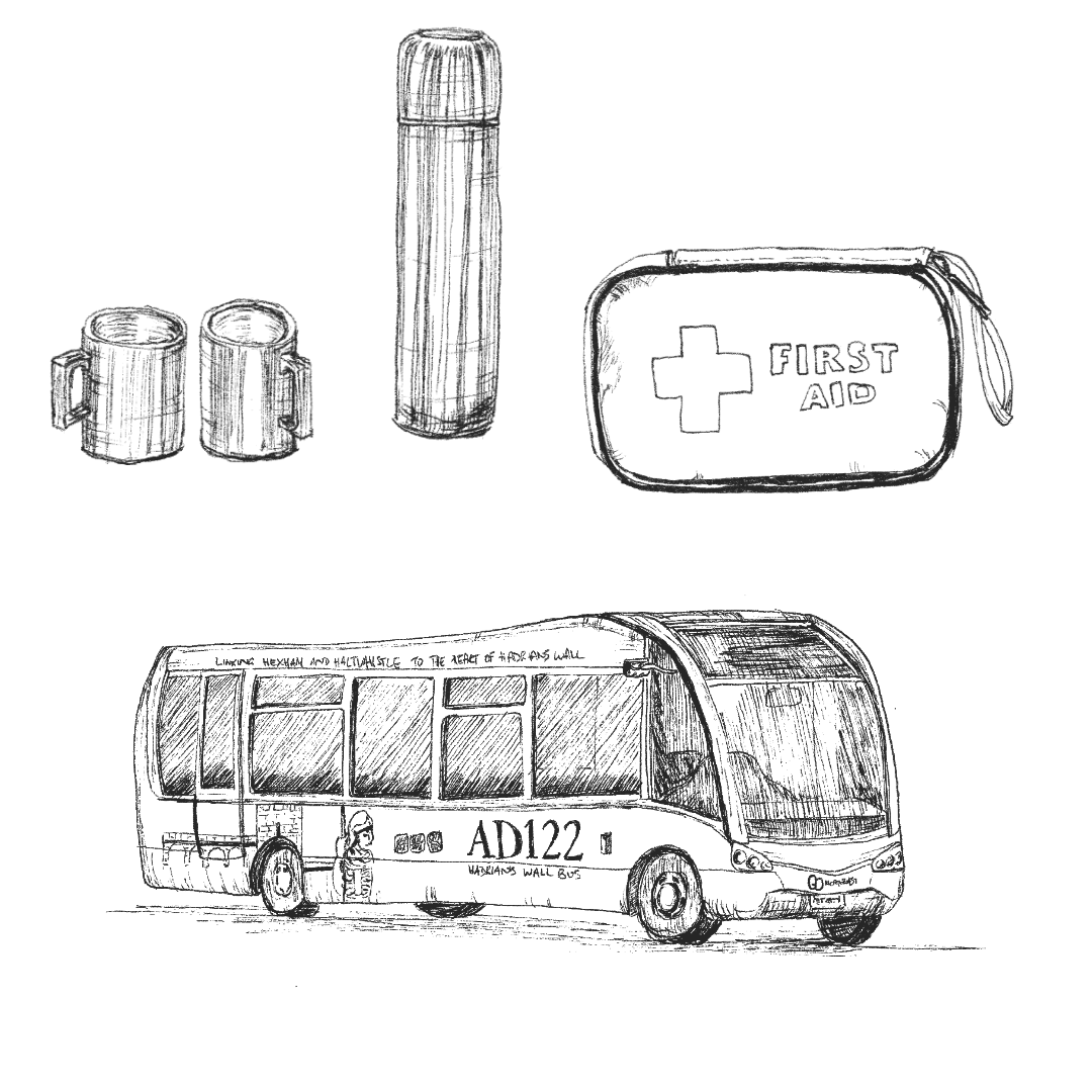
In addition to illustrations that were perhaps more ‘obvious’ for a map of the Hadrian’s Wall Path, including Forts and Museums, as well as the Wall itself, the artwork ended up including a wide range of elements that were very bespoke to Joe and Jackie’s personalities and interests. From Day 5's 'welcome coffee van' discovery or the Day 6 bus ride to Hexham to stock-up on Compede and emergency knee strapping (I told you that sometimes the story is about what was 'endured'!)
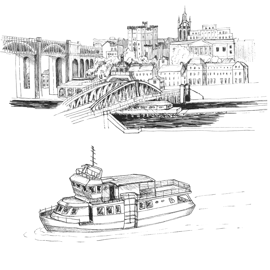
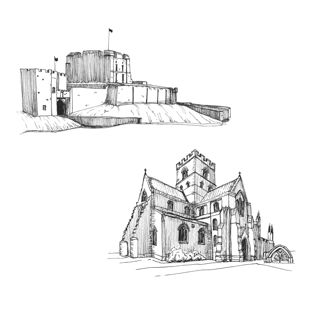
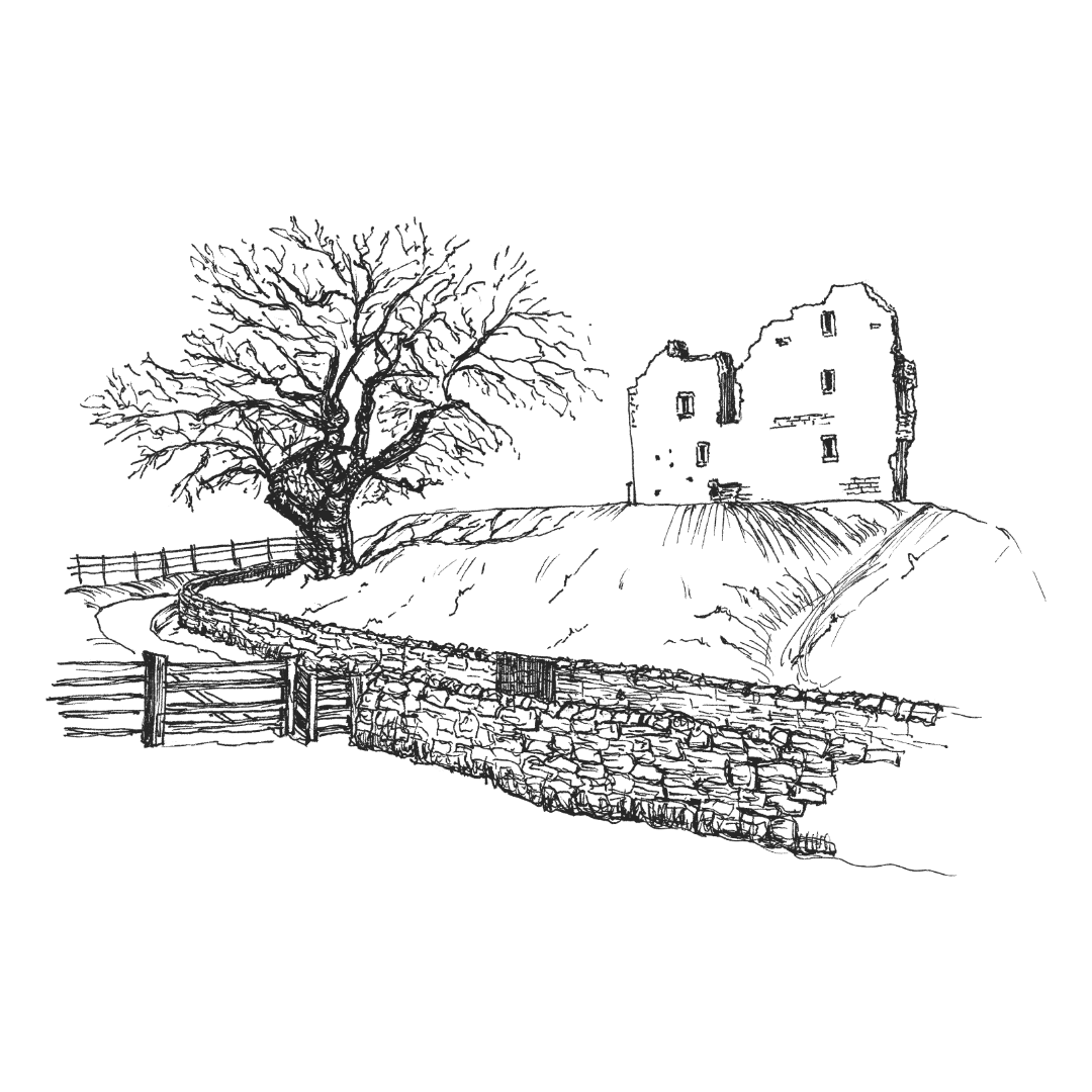
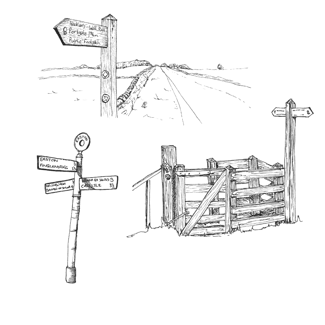
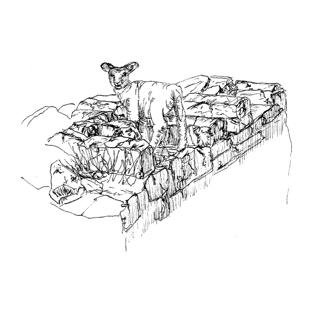
I also included illustrations to capture a range of sights and activities that they enjoyed, from visiting the church at the site of the Battle of Heavenfield, to some Dark Sky stargazing at the Sill National Landscape Discovery Centre, an extra ascent to visit Thirlwall Castle and the moment that they came across a lamb on the Wall.
I create all of my illustrations for map artwork as stand-alone pieces that I then knit together digitally. One of the benefits of this is the added flexibility it gives in terms of making amendments or adjustments as the work progresses. As the work progressed, Jackie realised that she really wanted to capture the variety of fingerposts, gates and stiles that they had encountered and so I was able to move around the existing illustrations in order to fit in some examples of these across the route.
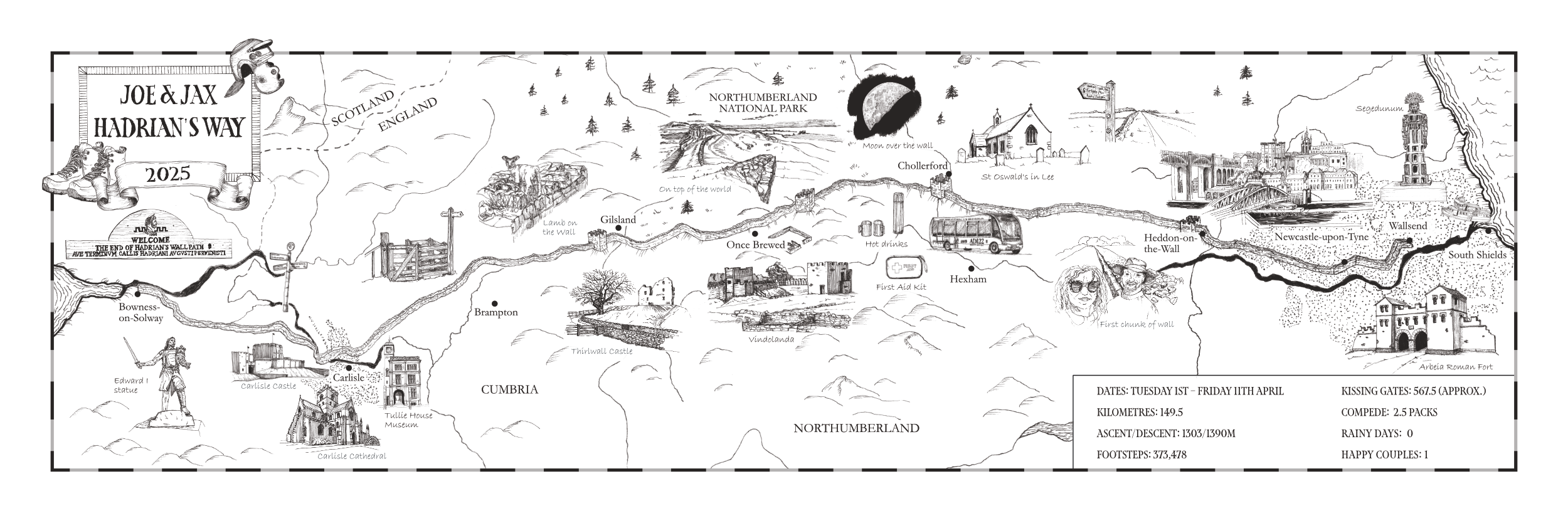
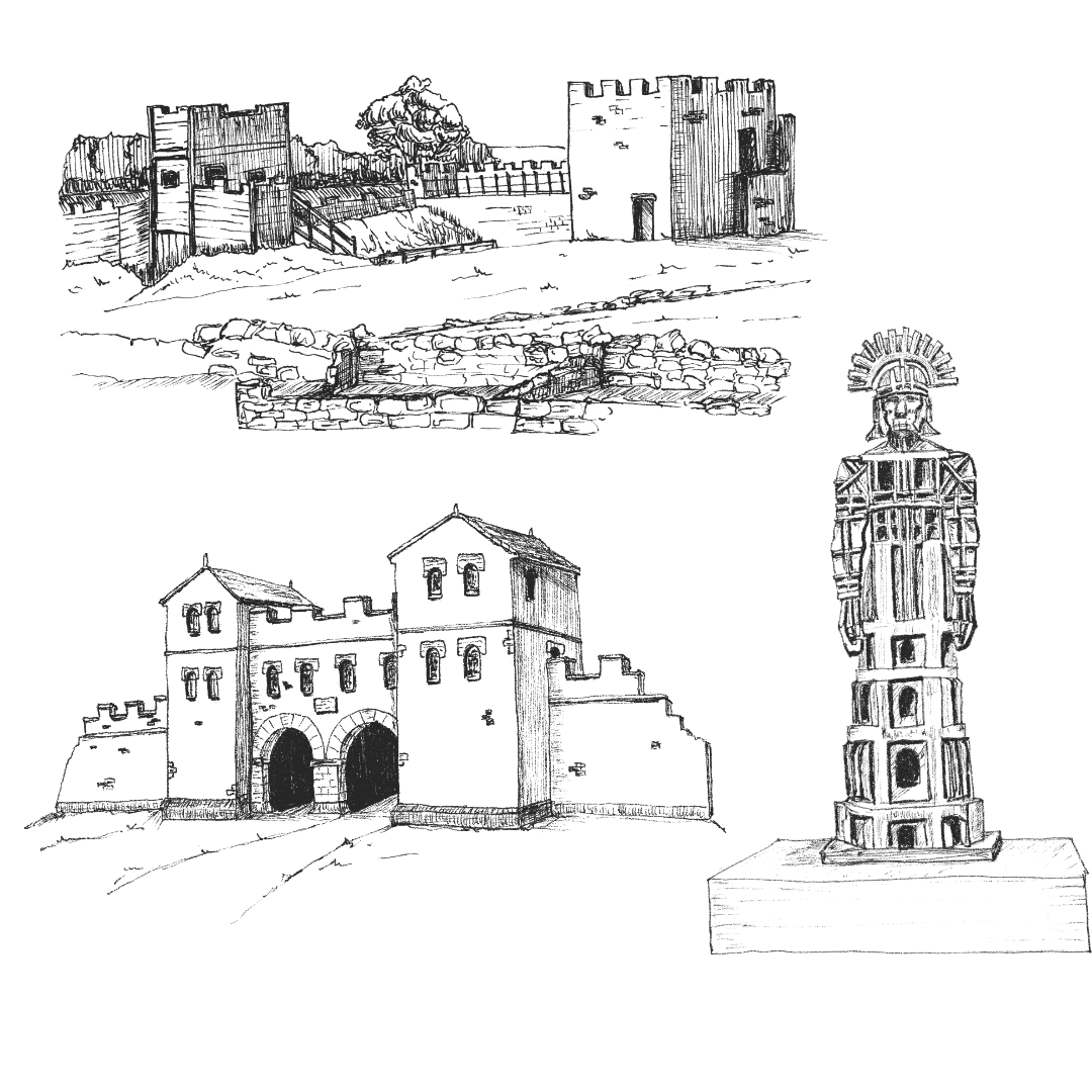
The final illustrated map
Client testimonial
“Working with Ali was a joy. She's such a collaborative and conscientious artist who listens to and reads information carefully - and I did rather bombard her with an exhaustive journal and photos of our walk! She stuck to time and budget commitments and was proactive in suggesting tweaks to enhance the project and make it an even more special surprise gift for my husband. The personalised map we now have is a beautiful record of our Hadrian's Wall hike, and makes us smile each time we see it hanging on our wall.”
What this project ultimately reinforced for me is that landscapes are never experienced in quite the same way twice. Every walker notices different details, pauses in different places, and carries away a slightly different story.
For organisations responsible for caring for and interpreting places like this — whether through trails, visitor experiences, or public engagement — the challenge is often how to acknowledge that richness of experience while still offering clarity and guidance. Illustration can sit gently within that space, offering fragments of narrative that visitors can recognise, relate to, and carry forward as part of their own experience.
It’s a role for illustration that feels less about explanation and more about accompaniment — walking alongside the stories that places continue to generate.
I increasingly work with organisations developing trails, interpretation, and visitor experiences where illustration helps create that narrative continuity across a place. If that’s something you’re considering, you might like to visit my Commissions section.