Notes from Northumberland
The story of a self-taught illustrator and designer living in England’s most northerly county
Six things an illustrated map can do that no other format can
Over the past few years I've worked on illustrated maps for a wide range of clients: heritage organisations, farmers, authors, and private individuals commissioning personal gifts. What strikes me, looking back across these projects, is how differently each map was being asked to work. Not one of them was simply about geography.
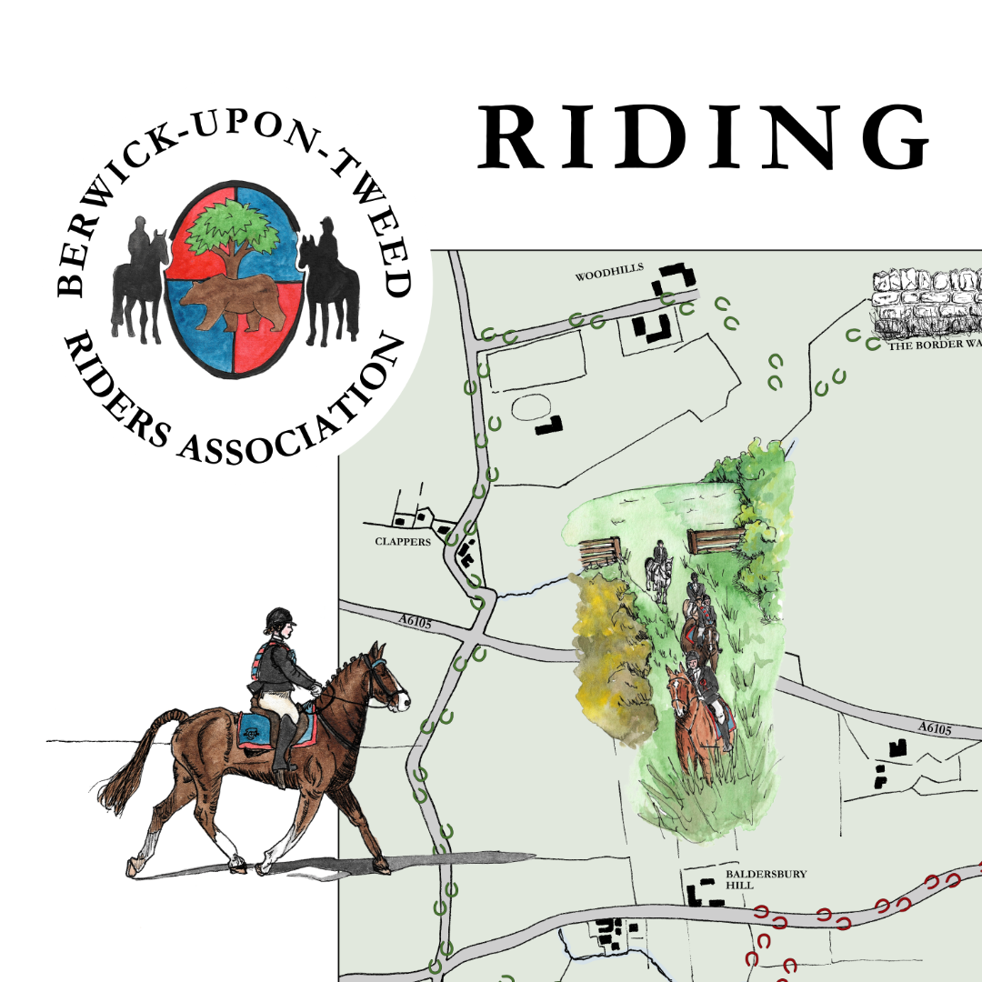
From Saddle to Sketch: Illustrating the Riding of the Bounds of Berwick-upon-Tweed
When photographer and web designer Sarah Jamieson got in touch about creating a bespoke illustrated map to anchor the new website that she was designing for the Berwick Riders Association to help tell its story visually, I knew it would be a special project — one that celebrated not just geography, but heritage and community spirit.

Project Announcement: Funding to illustrate Wilson’s “Tales of the Borders”
I applied for some grant funding this summer for support for a project working in partnership with local organisation, the Wilson's Tales Project, and Berwick-upon-Tweed Library. With sincere thanks to Create Berwick and their funders - the North East Combined Authority and Northumberland County Council - I'm thrilled to announce that the grant was awarded in late August. In addition to creating some illustrations of my own inspired by Wilson's Tales of the Borders, I'm going to be designing a self-guided walking trail leaflet, and running some workshops to support others to create some artwork inspired by the Tales, culminating in an exhibition in the Library.

Bespoke Illustrated Map Gift Featuring Iconic UK Race Circuits
Take a behind-the-scenes look at this bespoke illustrated map commission featuring five iconic UK race tracks. A meaningful gift created in ink and watercolour for a 70th birthday – complete with a custom car illustration and hand-drawn circuit logos.