Illustrated Maps
I've always loved maps - from the illustrated ones at the front of a book showing real or imagined places, to historic maps that reveal how people once understood the world around them. What interests me most is how maps can help us to see a place or understand a journey, rather than just way-finding (although, of course, they're excellent for that, too!)
When I'm creating a new map, I tend to think about how I want to interpret a landscape, what character and connections I want to capture and how I can bring this all together to help people feel more connected to where they are. I hand-draw or paint all of the elements for my maps (depending on the style that I’m aiming for) and then create the finished map using graphic design software. You can see a selection of my original maps below.
I work with estates, landowners, charities and heritage organisations to create illustrated maps and interpretation for visitor maps, interpretation boards and printed material. I also take private commissions, often producing one-off illustrated maps as meaningful, personal pieces of artwork. You can find out more about working with me on my Commissions pages.
Some of these maps are available as A4 and A3-sized eco-friendly art prints, so if you’d like to purchase a map please visit my shop.
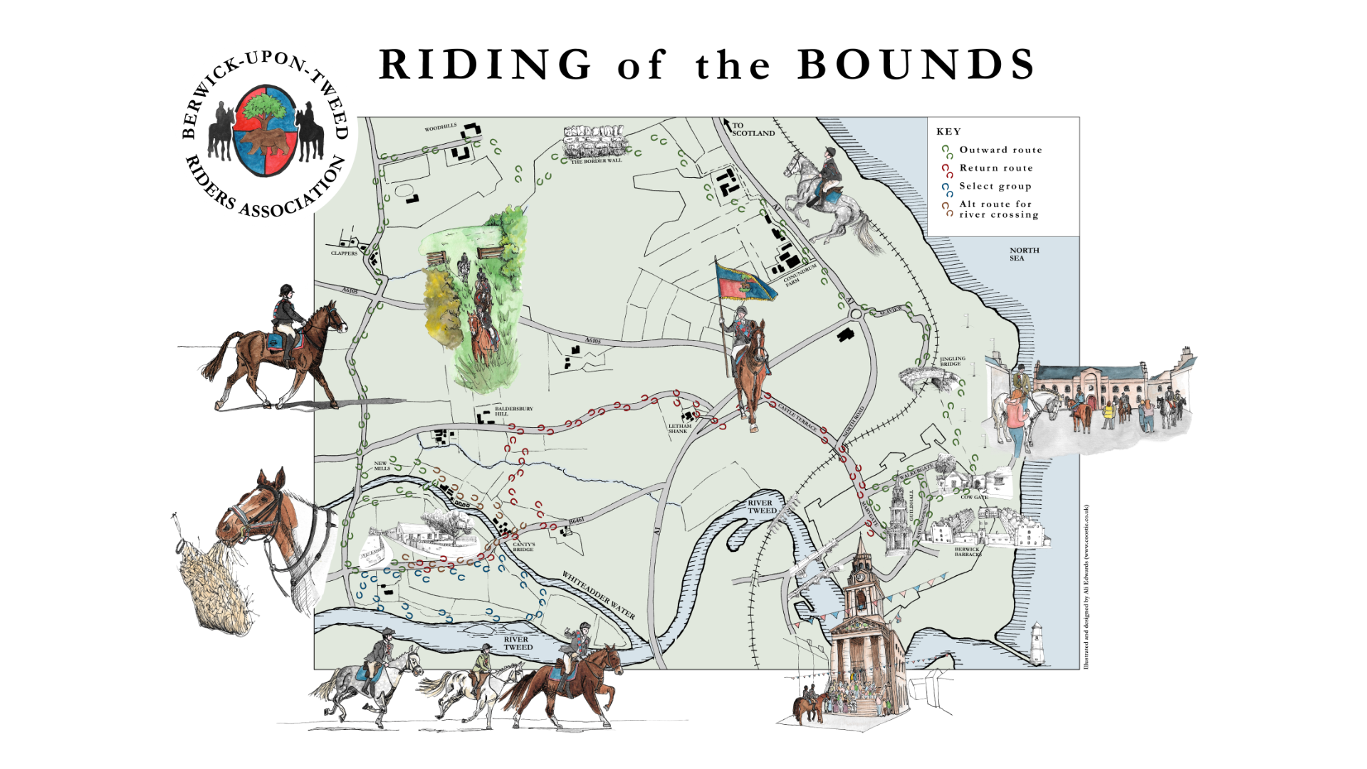
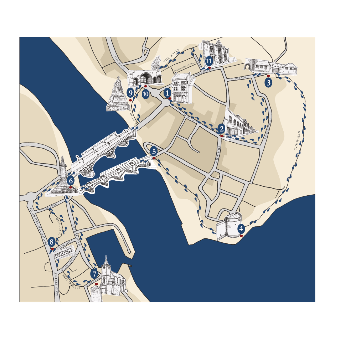
Riding of the Bounds Illustrated Map
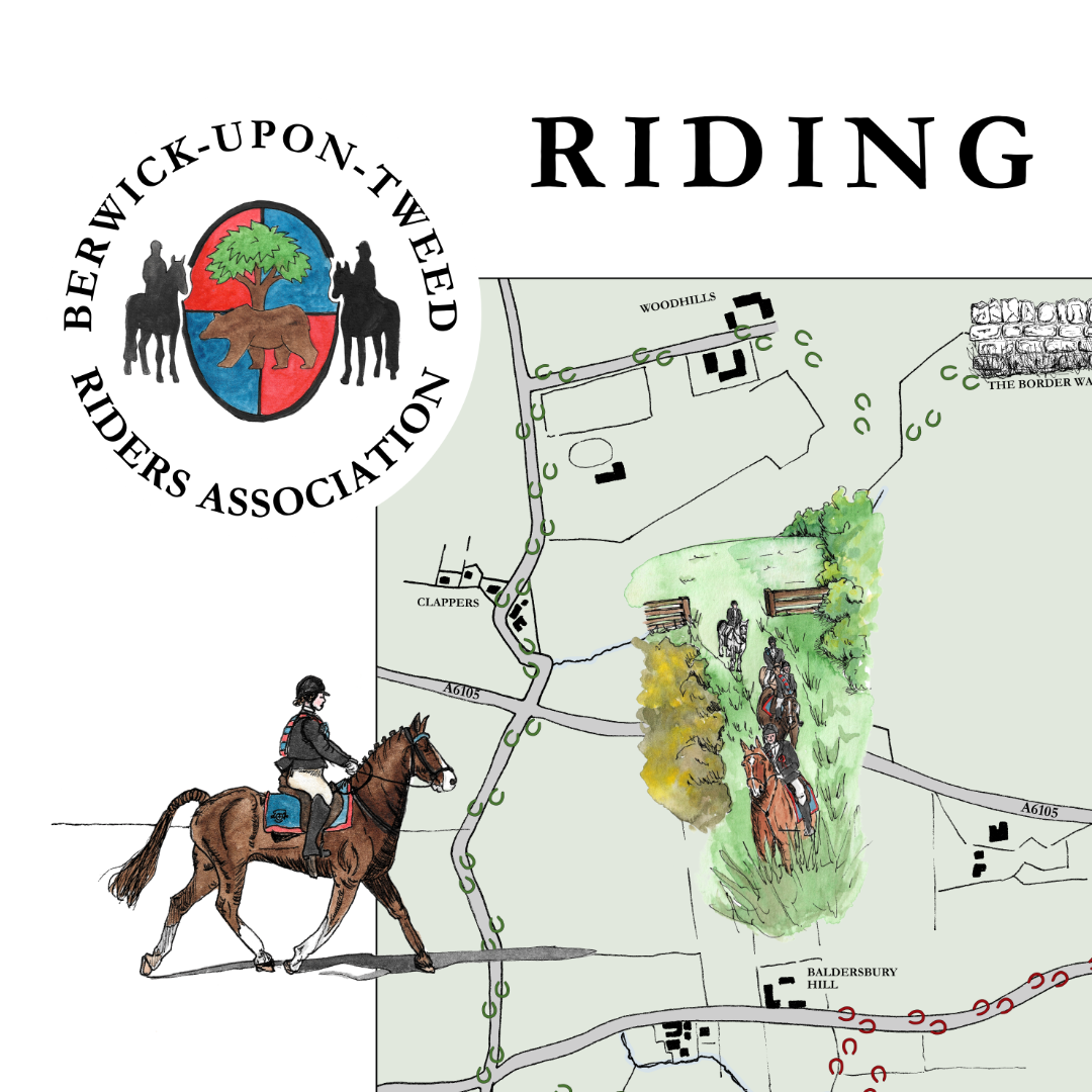
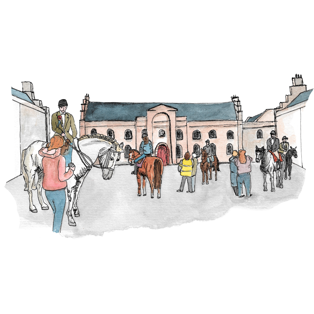
Riding of the Bounds Illustrated Map - Detail
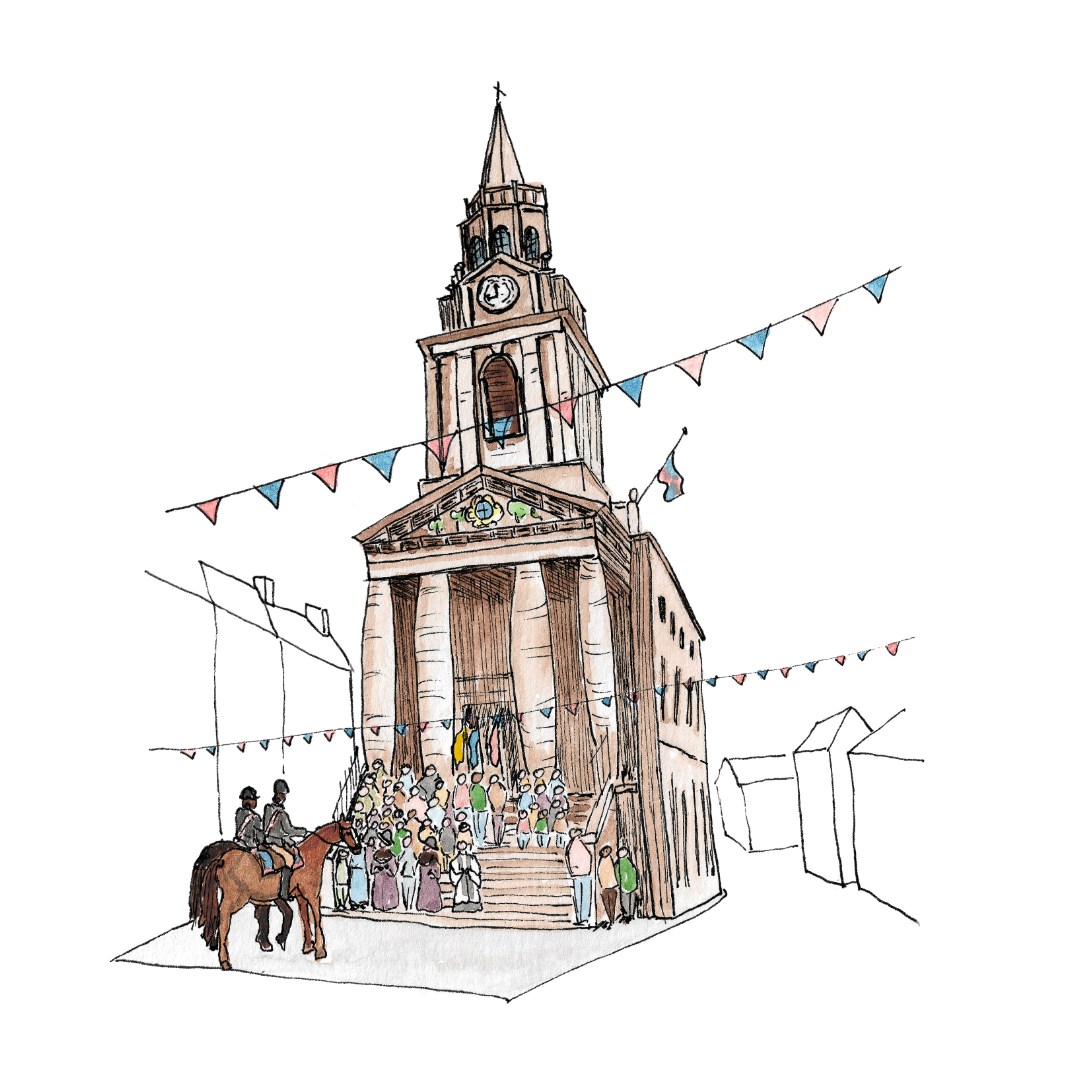
Riding of the Bounds Illustrated Map - Guildhall illustration
Riding of the Bounds Illustrated Map - Barracks illustration
Self-guided Walking Trail map: Walk with Wilson
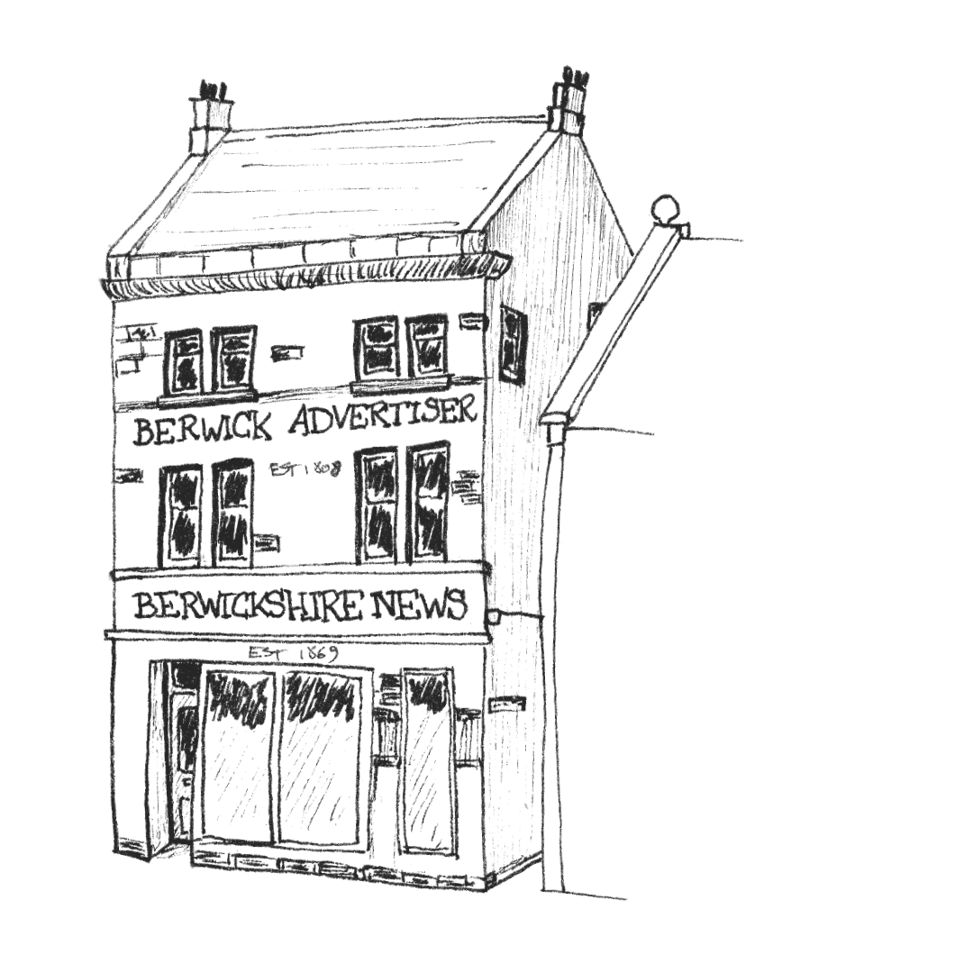
Self-guided Walking Trail map: Walk with Wilson - Berwick Advertiser building icon

Kypie Farm Welcome Board with Illustrated Map
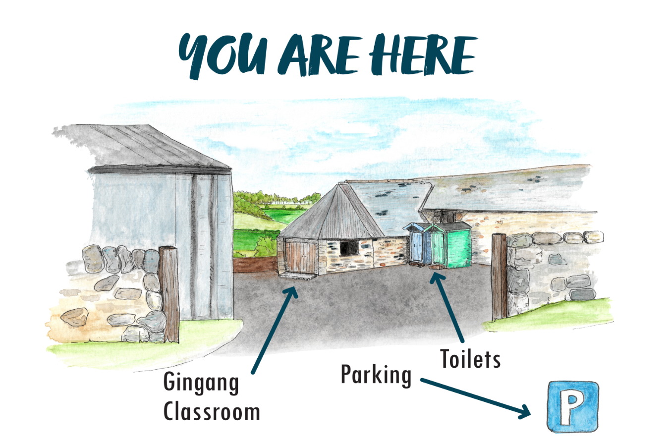
Kypie Farm Welcome Board with Illustrated Map - detail
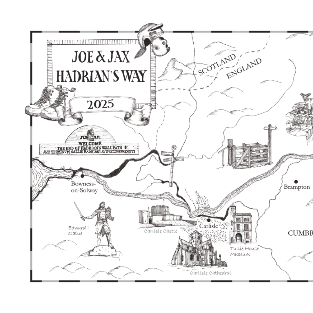
Hadrian's Way private commission - left
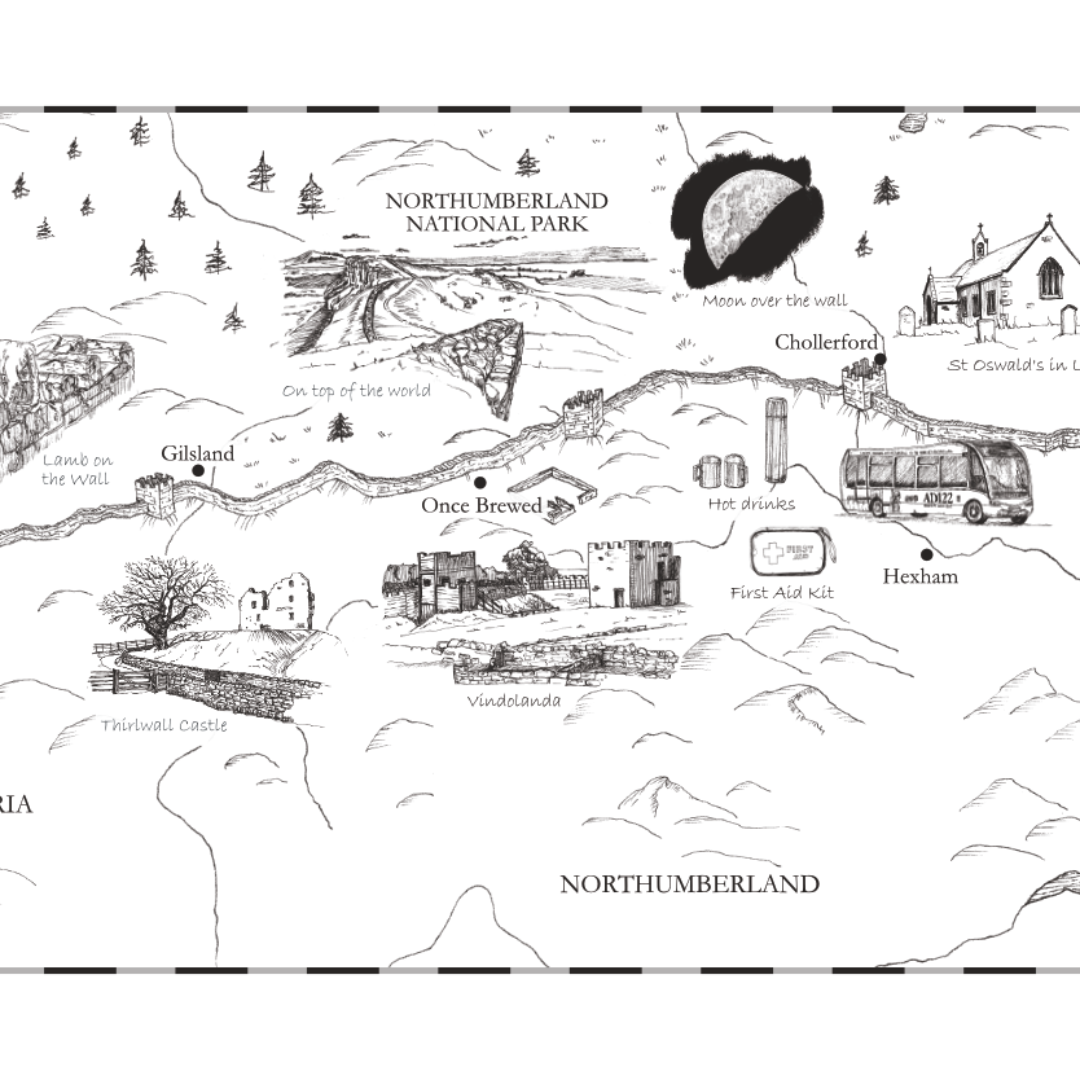
Hadrian's Way private commission - centre
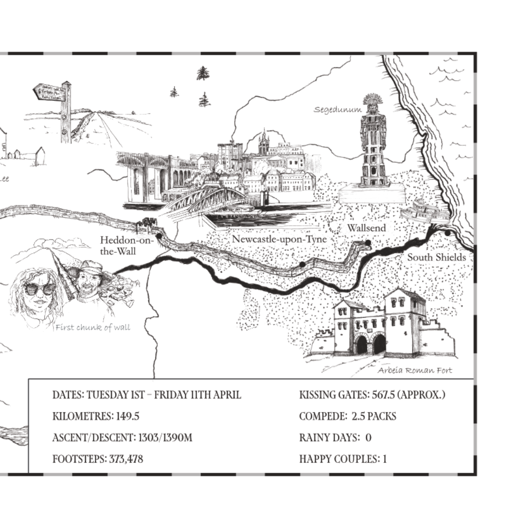
Hadrian's Way private commission - right
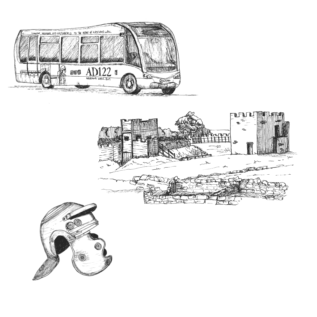
Hadrian's Way private commission - icon details

English Motor Racing (private commission)

Literary Map: 16th Century Berwick-upon-Tweed for an historical novel (Lady of the Quay)

Literary Map: 16th Century Berwick-upon-Tweed for an historical novel (Lady of the Quay) - castle detail

Literary Map: 16th Century Berwick-upon-Tweed for an historical novel (Lady of the Quay) - ship detail

Illustrated Journey Map (Private Commission)

Illustrated Journey Map (Private Commission) - Cafe/Bar illustration
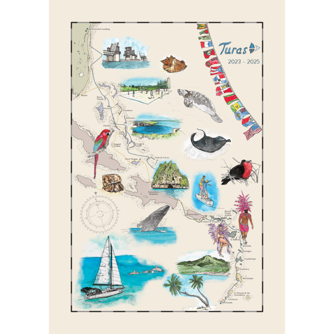
Illustrated Sailing Adventure Map (Private Commission)
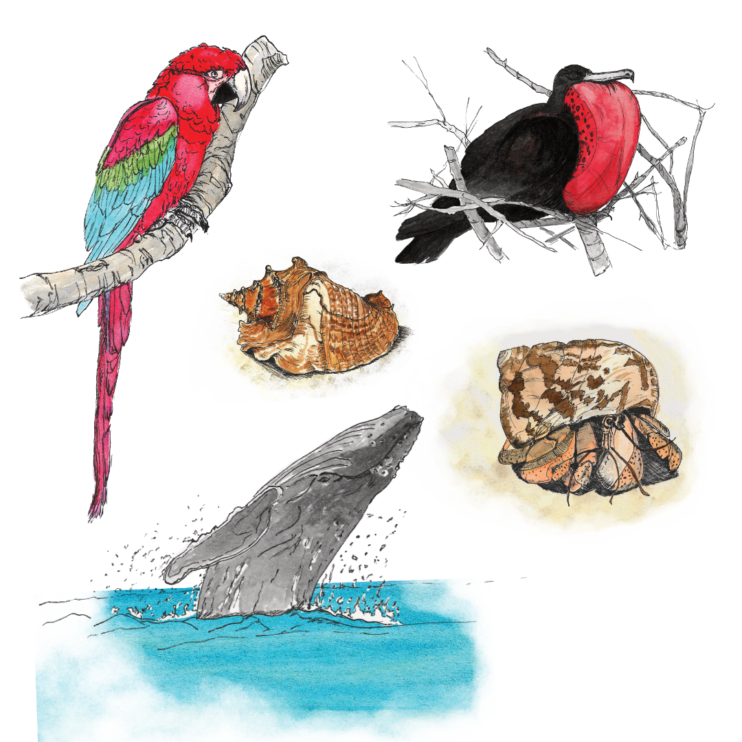
Illustrated Sailing Adventure Map (Private Commission) - selected illustrations

Coastal Birds of North Northumberland Illustrated Map

Coastal Birds of North Northumberland Illustrated Map - detail

Illustrated Holiday Journey Map (private commission)

Illustrated Map of Berwick-upon-Tweed

Illustrated Map of Berwick-upon-Tweed - detail